Hiking trails in the Portovenere Regional Nature Park

Trail N.1 - From Porto Venere to Campiglia
Access: Piazza Bastreri, Portovenere. You can get here by car or by bus – lines 11 or P – or by ferry from La Spezia or Lerici.
Estimated time:
Approximately 2 hours
Difficulty:
Medium
Route
Cutting across the Portovenere Regional Nature Park this trail is among the itineraries preferred by those who wish to go from the La Spezia Gulf to Campiglia. It is also popular because it is marked by the C.A.I (Club Alpino Italiano) and maintained by the Club’s volunteers. Trail N. 1 starts in Porto Venere and ends in Campiglia, a small inland town.
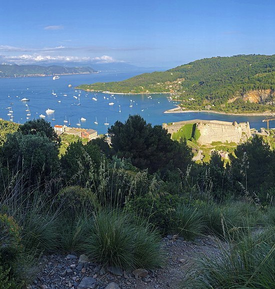
- The trail starts in Piazza Bastreri: just take the steps behind the Castle, and you’ll reach its access point. The trail starts with a fairly steep uphill through the Mediterranean scrub
- At about 200 meters above sea level you’ll reach the Canese quarry junction, (see Alternative Route 1/A). Continue to the right, towards Mortea, where the Rifugio Muzzerone rises; it’s not time for lunch yet, but it’s a great spot to stop and take photos of Palmaria Island!
- The trail then unwinds through areas called garrigue, with small shrubs with gray-green tones alternating with rocky, rubble soil, until you reach the paved road that leads to Sella Derbi, where you’ll capture splendid views of the sea.
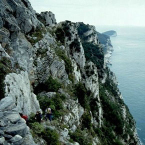
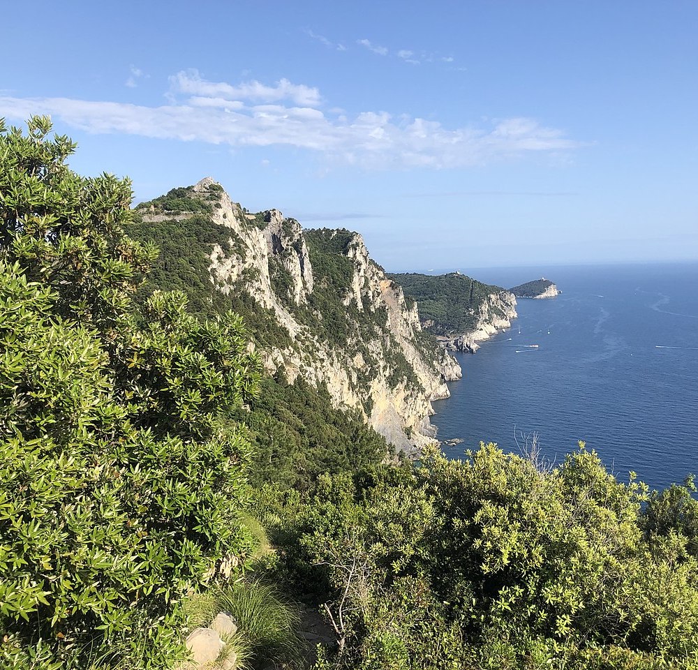
- The trail then continues uphill, and passes through Pitone, i.e. “viewpoint” in the local dialect: you’re atop a vegetation-clad rocky spur that offers exhilarating sweeping vistas encompassing the islands of Palmaria, Tino, and Tinetto to the left, and the coast of the Cinque Terre to the right.
- Walk on, following the seaward slope of Monte Castellana until you reach the paved road. Then take the path through the pine forest. When you see the sports field, you’ll be in the village of Campiglia. Paths and trails that start in the Gulf of La Spezia also converge here.
Alternative Route 1/A
- This Alternative Route starts at the Canese quarry. Once here, instead of turning right to reach Rifugio Muzzerone continue straight on, up the steep slope that leads up to the Muzzerone Fortress. From this viewpoint, you’ll enjoy a fabulous vista of the rock gym.
- Then walk down along the paved road until you reach Sella Derbi on the Grazie inlet. Here you can rejoin the main C.A.I trail N.1 – and in this case follow the directions at point n.4 above.
- In alternative, once you’ve reached Sella Derbi, you can follow the Alta Via del Golfo (AVG) and walk along the inner slope of the Monte Castellana.

Tour of Palmaria Island
Access: From Terrizzo, which you can reach by regularly scheduled boats from Portovenere or La Spezia.
Estimated Time: 3 hours and 30 minutes.
Difficulty: Medium.
Route
This trail is mostly sun-exposed, encompasses sections with varying degrees of difficulty, and alternates up- and down-hills for a total elevation gain of 198 meters: to tackle it you will want to be fit and properly equipped.
- The trail begins in Terrizzo, Palmaria’s main harbor: a dirt road that skirts the part of the island that faces the Gulf of La Spezia takes you uphill, offering lovely glimpses of the Umberto I Fortress, the Scola Tower, and the numerous small beaches of Cala della Fornace.
- If you wish, you can take a detour following the uphill path on your right: it leads to the former post station located in the Il Roccio neighborhood. You’ll want to stop for a minute to enjoy one of the most views in Liguria, surrounded as it is by flowering broom, red valerian, and red cistus.
- Continue on along the path, which runs along the south-facing side of the island, and you’ll find Mediterranean scrubland alternating with garigue and ilex groves
- A steep downhill takes you to Pozzale beach, another harbor for local ferries: from here you can walk along the seafront and reach the Portoro quarry, where Portovenere’s typical marble, a type of limestone, used to be extracted.
- Climbing once more, and leaving the view of Tino Island behind, you’ll reach the wildest and most rugged section of the trail, and the summit of Palmaria, 186 meters above sea level, where the rare Portovenere cornflower thrives.
- Once on the main road, turn left to reach the Environmental Education Center (C.E.A.). Continue on until you reach the dirt road: this is where the island’s roughest path commences, and you’re right in front of the Arpaia promontory and the church of San Pietro.
- Once you’re at sea level again, just walk along the pleasant beach-lined path, caressed by the wind and surrounded by the sounds of the lapping of waves and screeching seagulls, to get back to Terrizzo.
Alternative Route 1 - Punta Mariella
Once in Il Roccio, take the path that leads to the sea instead of continuing towards Pozzale. In springtime, you’ll be surrounded by broom, valerian, and cistus.
Alternative Route 2 – Strada del Terrizzo
A little used road that connects the C.E.A. with Terrizzo. An easy 45-minute walk in the shade of majestic trees, typical of unspoiled vegetation.
Alternative Route 3 - “Road of the condemned”
Take the dirt road that starts on the right and runs alongside the Fort Cavour moat: you’ll find hairpin bends and steps that provide spectacular views from a variety of different perspectives.
Alternative Route 4 – Canalone
Walk down the steps that lead to the “Casa dell’Ammiraglio”: you’ll recognize its unique monumental pine tree. Follow the road and, after a couple of hairpin bends, take the path on the left: you’ll cross the wettest area of Palmaria and be in Terrizzo in about 20 minutes.

The path in the woods
(From Fezzano to trail n.1)
Access: At the curve before the cemetery of Fezzano, on the Napoleonic road between La Spezia and Portovenere, in the village of Fezzano. You can get here by car or bus, lines 11 or P.
Estimated time: 1 hour and 30 minutes
Difficulty: easy.
Route
This trail offers the opportunity to observe remarkably different natural environments in a brief time.
- The trail starts at the Fezzano bend: take the second set of steps on the right (Via Ruggeri, then Via Alloria) to reach Via Simonetta Cattaneo, cross it, and continue for about 50 meters. At the crossroads, on the left, you’ll notice a path marked by an electricity pole and a rock.
- This is a “wild” area, with ample stretches of fallow land. In springtime, you might have to cross a small stream that flows from the Marsignano spring.
- Walk by terraced olive groves, then enter the shady ilex grove that rises in the area called Carame, and finally get to the dirt road that crosses the forest above Panigaglia Bay
- Once on the road that leads to Mount Castellana, in the area of Pezzino Alto, you’ll find a road to the right: it takes you straight to Mount Castellana, whereas the path to the left leads to Sella Derbi and C.A.I. trail n.1.
Alternative Route
Just before the trail enters the ilex grove you’ll see an uphill path that leads through the twelve Stations of the Cross and up to the “Jubilee Cross”. At night, it is lit and hence visible from the road that goes from La Spezia to Porto Venere. This path leads to the Alta Via del Golfo (AVG) towards La Spezia. If you continue on the dirt road, instead, you’ll reach Sella Derbi and C.A.I. trail n.1.

The Martina path
From Le Grazie to Portovenere
Access:
Le Grazie. You can get here by car or by bus, lines 11 or P.
Estimated time: 1 hour and 30 minutes
Difficulty: Easy.
Route
The path that connects Le Grazie with Portovenere crosses the area called “Martina”. Its name derives from an ancient legend about a maiden called Martina.
- At the Le Grazie cemetery walk down the steps, turn right, and walk along Via degli Scavi Romani keeping the entrance to the Villa Romana del Varignano to your left.
- Once on the paved road to Portovenere cross the street and continue uphill, along the small path named after St. Anthony.
- After passing a small church, follow the uphill path until you see a detour to the left. Turn left and walk on: the trail unwinds immersed in the typical Mediterranean vegetation, and you’ll have the chance to admire lovely views of Palmaria Island and Portovenere.
- When you find a group of houses, turn left and then, abruptly, to the right; the path continues among garden terraces where locals grow vines, and reaches the upper part of the village: you’ll see the mighty Doria Castle right before your eyes.
- Walk down the steps of St. Catherine’s to get to Piazza Bastreri: this is where the pedestrian zone of Portovenere, a UNESCO-listed World Heritage Site, begins.